Maroochy River
The Maroochy River rises from the eastern slopes of the Blackall Range and flows through the Eumundi area before entering the sea at Cotton Tree
The Maroochy River rises from the eastern slopes of the Blackall Range and flows through the Eumundi area before entering the sea at Cotton Tree. The two main arms of the river are known as North and South Maroochy Rivers. The Maroochy’s tributaries include Petrie Creek with the main tributary Paynters Creek as well as the creeks of Eudlo, Coolum, Doonan and Yandina.
Rafts of cedar, beech and pine logs were a common sight in the Maroochy and Mooloolah Rivers from about 1864 till the late 1800s. Chambers Island was the collection point for the rafting grounds situated further up the Maroochy River.
During the early days of settlement the only way of travelling from the inland town of Yandina to the coastal town of Maroochydore was to come by boat down the Maroochy River. For residents of the Nambour area, goods from Brisbane were delivered to Maroochydore, taken by paddle steamer to Deepwater and then punted up river for collection.
A major event in the development of transport needs on the North Coast was the opening of the North Coast railway line in the late 1880s. The railway line had been built in sections coming down from Gympie to Yandina pushing up from Brisbane to Landsborough then through to Nambour where the sections joined in 1891. It would eventually eliminate the need for coastal steamers and the coaches of Cobb and Co. Wharves such as Coolum, Bli Bli and Yandina situated on the Maroochy were important to early local settlement.
O’Connor’s boats provided an early down river transport service for passengers and goods up until 1918 and from ca 1909 to 1953 William Coulson operated a motor boat service taking mail, goods and passengers along the Maroochy River from Yandina. This service was continued by Duffield and Gilby until the 1960s.
Improvement in road access and the introduction of new transport services in the 1920s provided other options for those living in isolated settlements. In 1927 a road was constructed from Maroochydore to the Gympie Road. More residents acquired automobiles and the number of buses operators increased in the district.
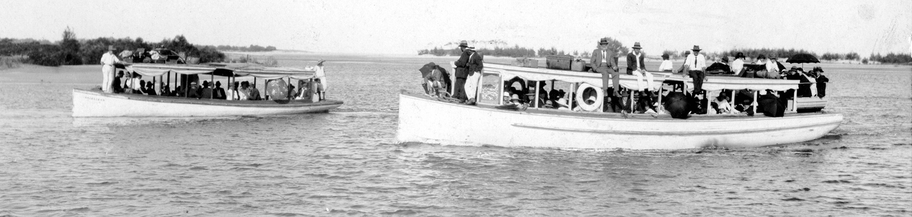
River traffic was still very important during this time. Tourists and day trippers loved a day on the Maroochy River too. Slade and Alexander provided weekend tourist buses from Nambour to the seaside town of Maroochydore. Tourists could then join up with Maroochy River boats for a cruise on Evan’s boats up the river to Dunethin Rock.
Best known of the early boats was ‘Favourite’ which sailed up and down the river to Petrie Creek and on to Deepwater, where it connected with the cane trams which carried passengers and goods from Nambour. In 1909 a wharf was built at Deepwater, which was named as such because that was as far as larger boats could safely navigate. The site is located where the present Wharf Road at Bli Bli meets Petrie Creek.
By 1930 the formation and growth of urban settlements had improved greatly in the Maroochy River region due to the many transport developments. For many years rivers such as the Maroochy remained an important link between the railway stations and the coastal towns. The ferry which crossed the Maroochy River from Bli Bli to service the settlers on the North shore ceased when the David Low Bridge opened in 1959. Coolum Creek wharf ended its main transport role in 1959 and is now used as a boat launching ramp. Remnants of the early wharves can still be seen on the river.
Another part of an historical era here on the Sunshine Coast.